
Search Harris County Streets by Address
Begin a Harris County street directory search with the physical address, not a guessed name. The free appraisal search can turn a street number into an account number, current owner label, situs address, mailing address, and legal description. That legal description is the durable bridge to recorded documents. A street number alone can lead to the wrong parcel when a road crosses cities, when a plat uses a similar street name, or when an older address was changed. Save the account and parcel details before moving to another source.
Each following stop tests a different fact. The property account supplies the present parcel lead. A recorded deed supplies a transfer record. The voter system is an individual confirmation tool, not an open street roster. A reverse directory can supply a dated historic address entry where its volume includes a street section. This order avoids treating one result as proof of a whole household.
- Enter the address in HCAD Quick Search. Record the account number, situs address, legal description, and owner label shown for the matching parcel.
- Open the same place in the Harris County GIS map. Confirm the parcel outline and inspect address labels, subdivision, lot or block, and jurisdiction layers.
- Use the legal description and current name in the County Clerk real-property index. Read the deed image when available, then note its grantor, grantee, recording date, and instrument number.
- If a person is already identified, use Texas My Voter Portal with the required individual details. It confirms a registration record but cannot browse the street address by address.
- For an earlier period, ask the Houston Metropolitan Research Center or Clayton Library about a reverse or criss-cross directory. Check the exact volume year because not every directory has a street section.
Note: A matching address begins a Harris County record trail; it does not establish who occupies every unit or who receives mail there today.
Harris County Street Directory Search Fields
HCAD Advanced Search accepts a street range, legal-description text, ZIP code, and mapping fields that help narrow a Harris County street directory search. Select the tax year first. Street-type words should be left out, directional prefixes should be abbreviated, and a range needs both beginning and ending street numbers. Search results are appraisal records, so use the County Clerk deed index to verify a transfer.
| HCAD field | Search use | Format or option |
|---|---|---|
| Tax Year | Chooses the appraisal year | Required for each search mode |
| Street No. and Street Name | Finds one address | Use the number; omit street-type words and periods |
| Similar Street Name | Tests spelling variants | Optional matching control |
| Beginning and Ending Street No. | Browses an address range | Both values are needed for range search |
| Street No. Zeros | Includes zero site addresses | Optional checkbox |
| Owner Name | Checks a parcel owner label | Last name plus first initial or name |
| Legal Description | Connects a parcel to deeds or plats | Partial beginning letters return variations |
| ZIP Code | Narrows parcel results | Five digits |
| Key Map or Map Facet | Uses HCAD map identifiers | Key Map is three numbers plus a letter; Map Facet is four numbers plus A through D |
The HCAD advanced-search screen shows the Harris County street directory fields used to narrow a range or ZIP result.
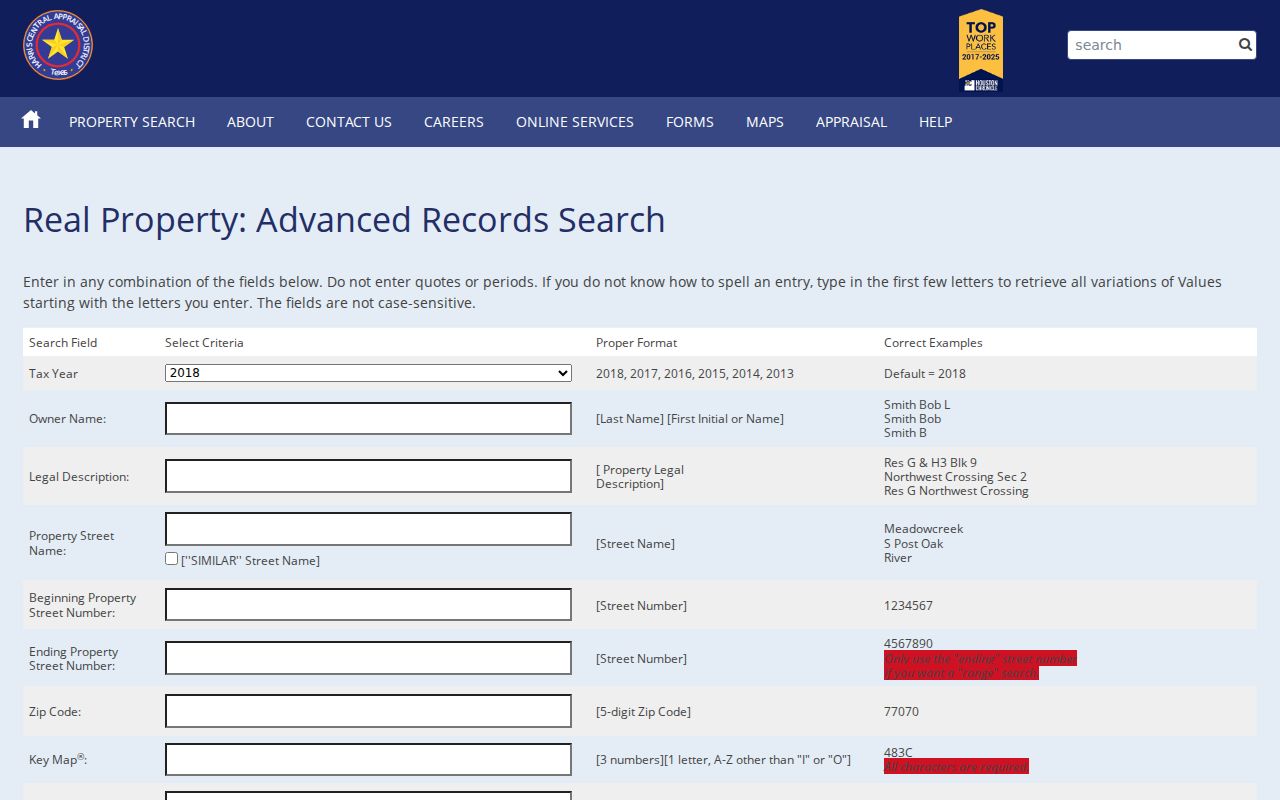
The form is useful for locating parcels on a street, but each result needs an account-by-account review before it supports a conclusion about one address.
Harris County Situs and Mailing Addresses
A situs address is the physical location of the parcel. A mailing address is where the appraisal district sends tax notices. Those are not interchangeable in a Harris County street directory search. The mailing line may belong to a different location, an agent, a business, or a post-office box. A homestead exemption is also limited evidence, because it shows an exemption claim for an account rather than a complete, current household list.
The practical cross-check is simple: use the situs field to identify the land and legal description, then compare it with the recorded deed. HCAD says its data does not establish title priority and is not a title opinion. The County Clerk instrument is the better source for a recorded transfer, while the appraisal account remains an address and parcel lead.
Note: When the mailing and situs fields differ, retain both values in research notes and avoid assuming that either one describes current occupancy.
Browse a Harris County Street in HCAD
HCAD offers two ways to move beyond one parcel. Advanced Search can pair a street name with beginning and ending numbers, and a property detail page can link to values on the same street. Both routes return appraisal accounts, not a roster of people. Work in short street segments, inspect each account separately, and preserve the legal description when an address appears ambiguous.
HCAD search help explains the address variations that matter in Harris County. It directs users to omit street-type words, avoid punctuation, abbreviate directions, try spelling variants, and use range searching when a single address fails. The data normally refreshes nightly, although occasional delay is possible.
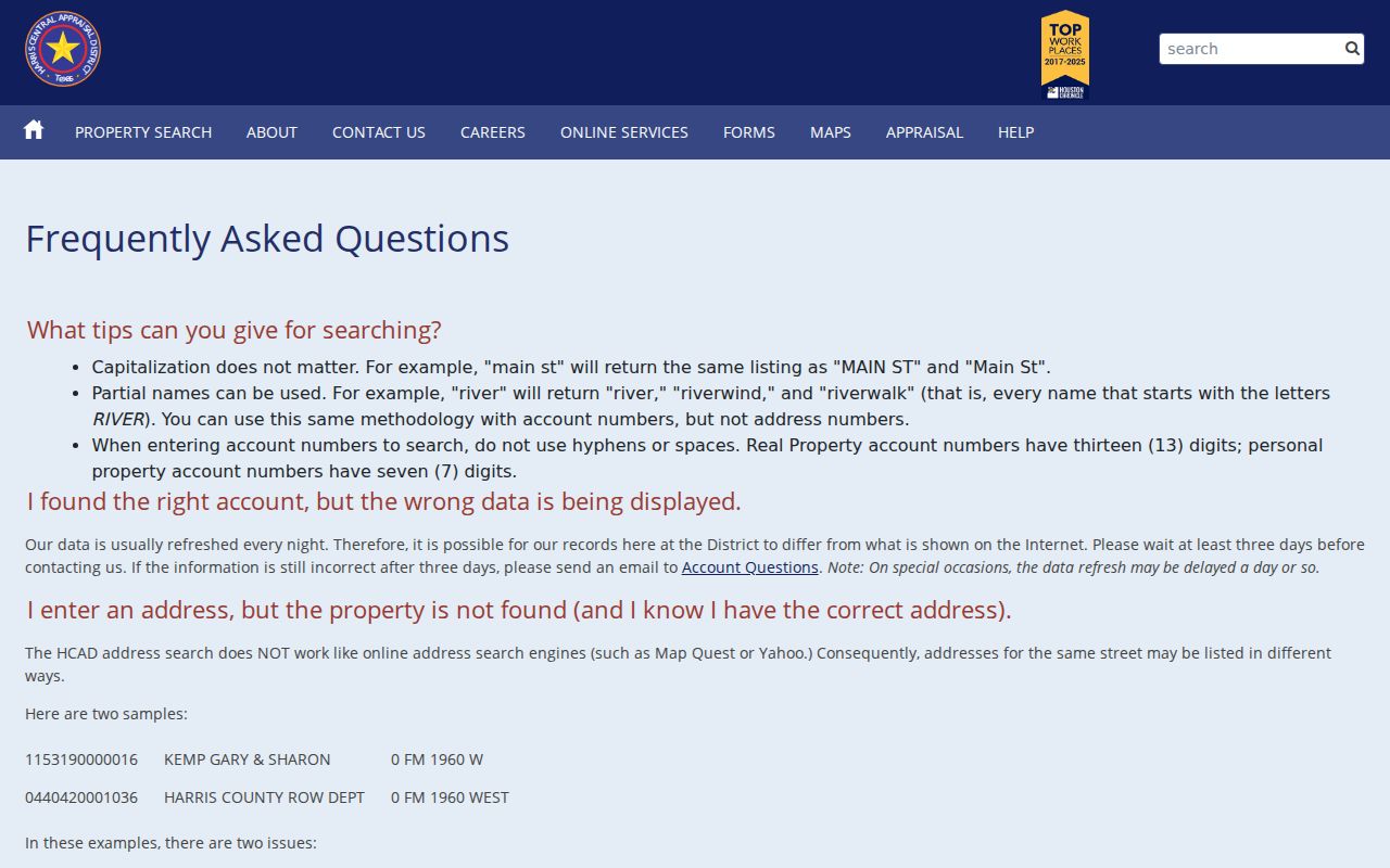
These instructions reduce missed parcel matches, especially when the street label in a deed, map, or older directory does not look like the current HCAD display.
Harris County Street Parcels and Plats
The map stage makes a street directory result more reliable. In the Harris County GIS viewer, search the address, select its parcel, and inspect the identifier, boundary, and available layers. Parcel, subdivision, lot or block, ZIP, city limit, precinct, school district, flood, historic, annexation, and HCAD layers can explain why two sources use different place labels. A plat or condominium map may connect a subdivision address with a recorded lot or block, although surveys are not generally filed with the County Clerk.
The Houston GeoLink map supplies a city-focused companion view with parcel, permit, and jurisdiction layers for addresses inside its coverage.
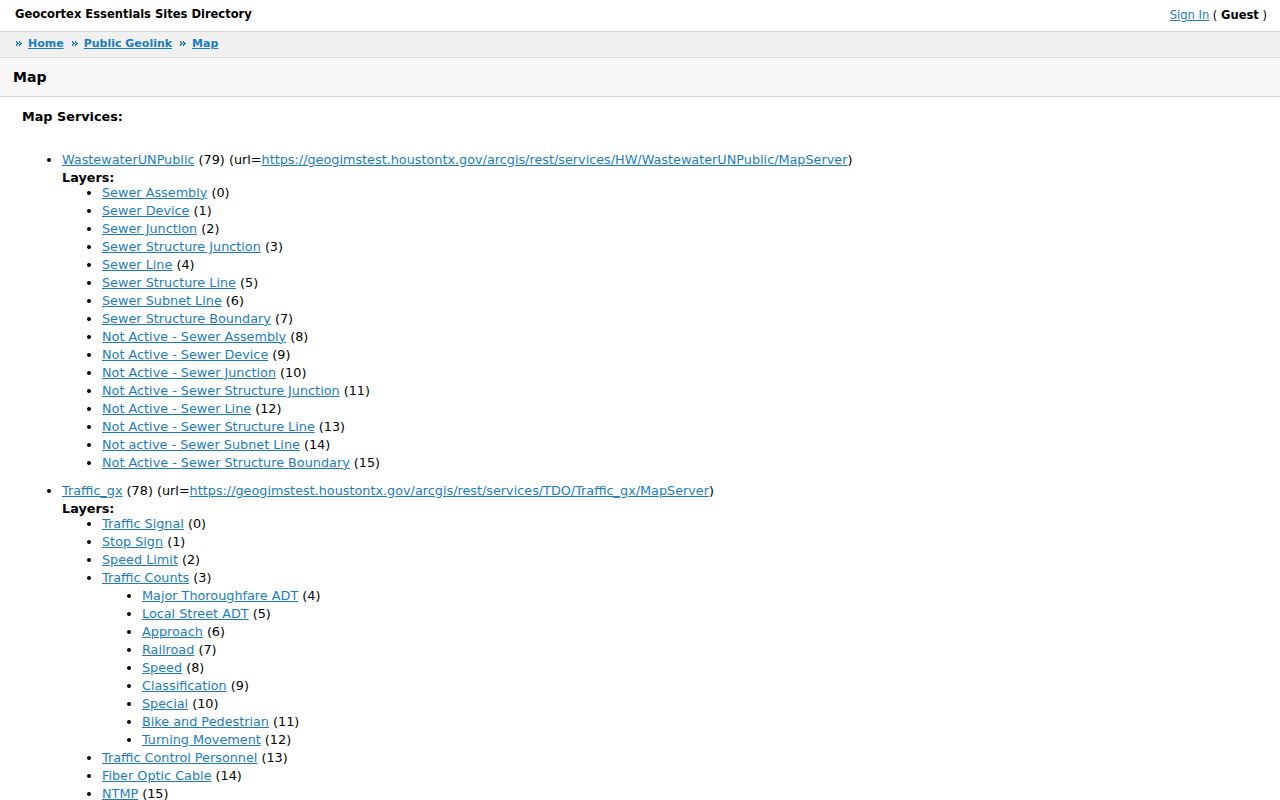
GeoLink adds city context, while the county GIS viewer remains the broader parcel route for Harris County addresses and unincorporated areas.
- Parcel
- A mapped piece of land represented by an appraisal account and boundary. It is the starting unit for property research, not proof of a household.
- Situs address
- The physical property address used to identify where a parcel lies. It can differ from the address used for tax mail.
- Plat
- A recorded subdivision or condominium map that can show lot, block, boundaries, and related layout details.
- Criss-cross directory
- A directory section arranged by address rather than surname, when that specific volume includes one.
Use the parcel outline rather than a building shape when comparing nearby locations. A corner lot may front two streets, and a drainage area, railroad, alley, or district boundary can make a visual street sequence misleading.
Harris County Street Deed Trail
Recorded documents turn a property account into a document trail. In the County Clerk index, search the current owner as grantee and the prior seller as grantor. Capture the file number, recording date, instrument type, and legal description. Then search the seller as grantee to locate the earlier purchase. This is a parcel-by-parcel process, because a simple street-name query cannot safely distinguish every lot on a long Harris County road.
The Harris County Clerk Document Search Portal provides collection choices for real property, maps, plats, and other county records. The real-property portal states that images are available from November 1, 1960. A recording can take one to two business days to appear, and an online image is not the official repository or a guarantee of an unaltered record.
The County Clerk document portal shows the collection menu used to begin a Harris County street directory document search.
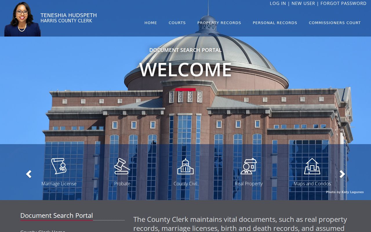
The portal is a route to the recorded index. When an image cannot be located, when a raised seal is needed, or when the record predates the practical online path, use the Clerk's copy-order, office, mail, fax, or email channels.
Harris County Street Voter Access Limits
A voter record is not a whole-street directory. Texas My Voter Portal requires an individual search using name, county, date of birth, and ZIP, with VUID or Texas driver-license alternatives. A result can confirm registration status and precinct context, but it does not display ballot choices. A non-match can reflect a spelling or ZIP problem, a protected or suppressed record, suspense, maintenance, or another condition. It is not proof that a person never lived at an address.
For a statutory registered-voter list, the request goes through the county registrar and is subject to required form, fee, intended-use, and protected-data rules. The Harris County Tax Assessor-Collector handles public tax services and serves as voter registrar, while Harris Votes provides election and voter-information routes. Neither channel turns the individual voter lookup into an address-browse tool.
The Tax Assessor-Collector service is shown here as a Harris County street directory access point for tax and voter-registrar context.
Use the tax and election channels for their own official functions, then return to the parcel and recorded deed for property-specific research.
Harris County Street Directory History
For who lived here before, the address section of an older directory can be more helpful than an alphabetical name entry. Houston directories are online from 1866 through 1924, with partial 1925 through 1959 coverage through HeritageQuest, and a physical run through 1986. The Houston Metropolitan Research Center also reports Yellow Pages through 2005. These are dated snapshots, not a complete account of every person at an address.
Reverse sections are volume-specific. If a digital scan has no useful street index, the local alternatives are the Houston Metropolitan Research Center and Clayton Library physical runs, plus HPL's email research service within its request limits. The fuller collection details belong with the Harris County city directory collections, while this address-focused trail uses only the year nearest the question.
Compare adjacent directory years and cite the exact volume and page. A blank entry, a different abbreviation, or an absent reverse section should not be treated as evidence that no one was associated with the location.
Harris County Street Address Geography
Harris County is not the same thing as the City of Houston. A postal city, ZIP label, municipal limit, county jurisdiction, subdivision, and legal description can point to different geographic systems. The GIS viewer includes city and county limits, ETJ, annexation history, MUD and private-utility areas, civic clubs, super-neighborhoods, historic districts, and HCAD parcel layers. Use those layers to explain a label difference rather than selecting a jurisdiction from a postal address alone.
Older directory entries can carry community names such as Kingwood, Clear Lake, Cypress, Klein, Aldine, Memorial, or the Memorial Villages. Search the address with its current parcel and legal description, then compare historic maps or plats if the street label has changed. No single Harris County renumbering year was located in the official material, so a claimed countywide date would be unreliable.
Note: The legal description and parcel boundary are steadier bridges across a street-label change than an address-only name match.
Why Zero Is a Harris County Address
HCAD documents an unusual search result: a property can carry site number zero when the district does not know the correct number or when a vacant-property process supplied the data. Do not discard that record automatically. Turn on the Zeros option, try a range search, remove the street type, and test the street-name variant. The same road may appear as an abbreviated directional form in one record and a fully spelled form in another.
When a zero address or map gap appears, the account number, legal description, and subdivision lot or block are more useful than forcing the street number to fit. HCAD also notes that an account can exist before GIS mapping is complete. A County Clerk deed or plat provides an additional way to test whether the parcel is the intended location.
Harris County Street Records Coverage
Address-keyed sources overlap but do not duplicate each other. The following Harris County street directory inventory keeps the distinction clear and includes the practical fallback when a web result stops short.
| Address record | Custodian | Useful result | Access route |
|---|---|---|---|
| HCAD parcel account | Harris Central Appraisal District | Owner label, mailing and situs addresses, account, legal description, value, exemption, and improvements | Free online search; phone or office correction route |
| GIS parcel map | Harris County GIS | Parcel shape, adjacent lots, and geographic layers | Free map viewer and separate tabular address search |
| Recorded deeds and plats | Harris County Clerk | Grantor, grantee, recording date, legal description, restrictions, and chain evidence | Online index and images where available; copy order, counter, mail, fax, or email fallback |
| Tax services | Tax Assessor-Collector | Tax statement, payment, delinquency, or tax-sale trail | Public tax services; live field extent varies |
| Voter registration | Texas Secretary of State and Harris County Elections | Individual status and precinct context | Name-driven portal; statutory list request has separate restrictions |
| Historic directories | HPL, HMRC, Clayton, and UNT Portal | Dated address, business, phone, or household clues where the volume supports them | Digital run, library database, physical shelf, or limited research-email route |
| Permit or code record | Municipal or county custodian | Work or case dates and public fields if available | Address, case, portal, 311, or Texas Public Information Act request; exact online coverage was not located |
County Clerk copies can be ordered through the office, mail, fax, or email when the owner or legal description is supplied. For older books, use a public terminal, an archive appointment, a copy request, or a written Texas Public Information Act request to the proper custodian. Ask for electronic delivery when available and expect statutory redactions.
Harris County Street Archive Scale
Modern deed research is easier because the County Clerk says real-property images are available from November 1, 1960. The FY2026 archive plan describes a far larger preservation effort: 72,000 microfilm rolls, more than 200 million images, and more than 16 million real-property images online. It also says pre-1961 books were scanned, while electronic indexing for 1836 through 1955 remains a project need. A scanned image is not the same as a searchable name index.
For a chain that reaches the older material, preserve the legal description before contacting the County Clerk or Harris County Archives. The archive plan identifies the Todd Street warehouse as the records setting for historic material, and the Archives offers research by appointment. That is the accurate fallback when a desired old deed cannot be found through the web index.
Harris County Street Directory Boundaries
A street directory can connect a parcel with public property, document, map, and historic-directory records. It cannot reveal every household member, visitor, delivery account, utility customer, motor-vehicle address, protected voter address, or sealed record. A person listed as an owner, grantor, voter, or historic directory entry answers only that record's narrow question. Confirm an important claim with the office that holds the record.
Lawful use. Use Harris County street and address records for personal, lawful research, family history, property verification, or civic curiosity. Never use a record to stalk, harass, intimidate, or harm another person.
Texas confidentiality rules can suppress or restrict voter residence information, and the Texas Address Confidentiality Program provides a substitute address and mail-forwarding protection for qualifying people. Public records also change, so an address result should be checked with its custodian before it is relied upon.